This is my presentation for the module 'Applied Creativity'. For this module we were asked to complete 4 tasks. 1. A printed way-finding system. 2. A digital way-finding system. 3. A physical way-finding system and finally 4. a digital journal/blog.
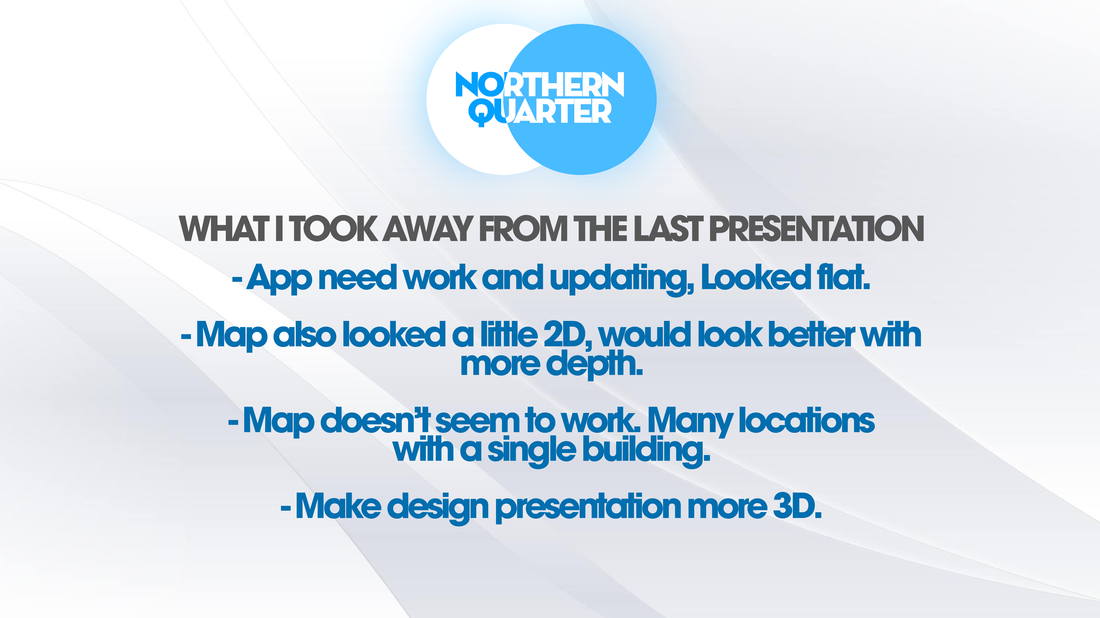
Welcome to my presentation on my outcomes from this module. The first thing that I want to talk about is what I gained from the last presentation (Slide 2). Personally, the last presentation help a lot with my development with this module. It gave me and insight into what other people thought of my work and what they would improve. Some things that I wouldn't have gained without doing it.
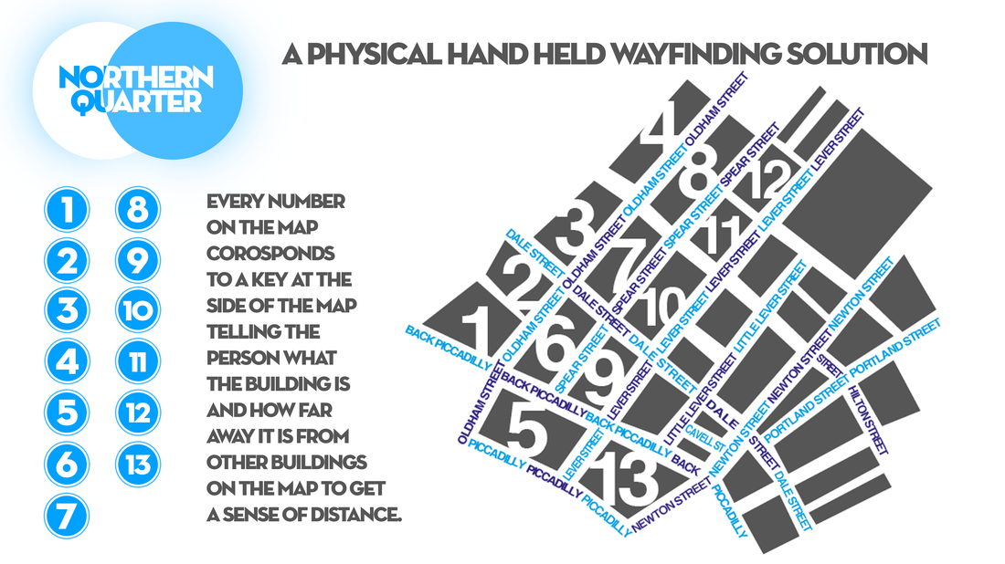
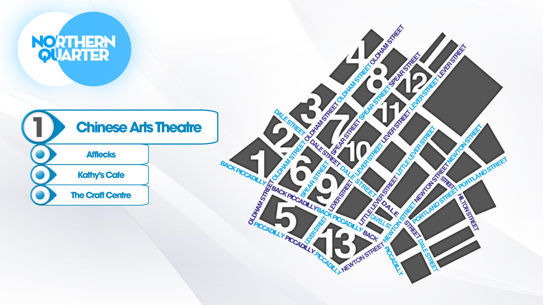
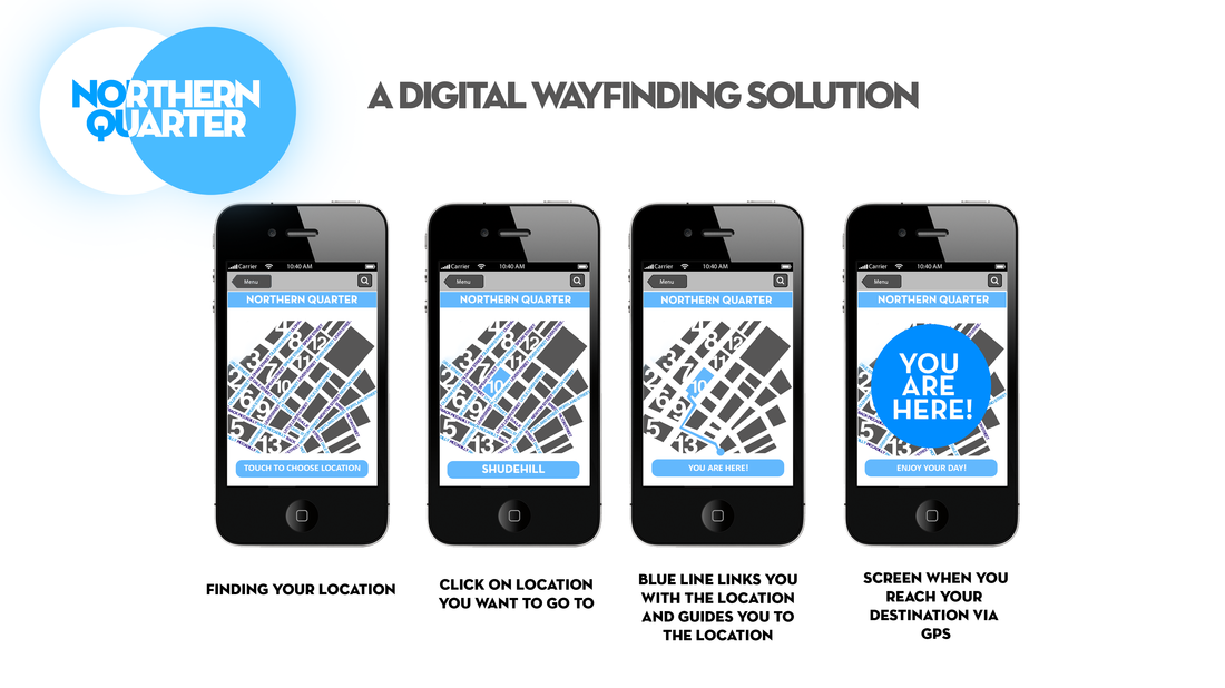
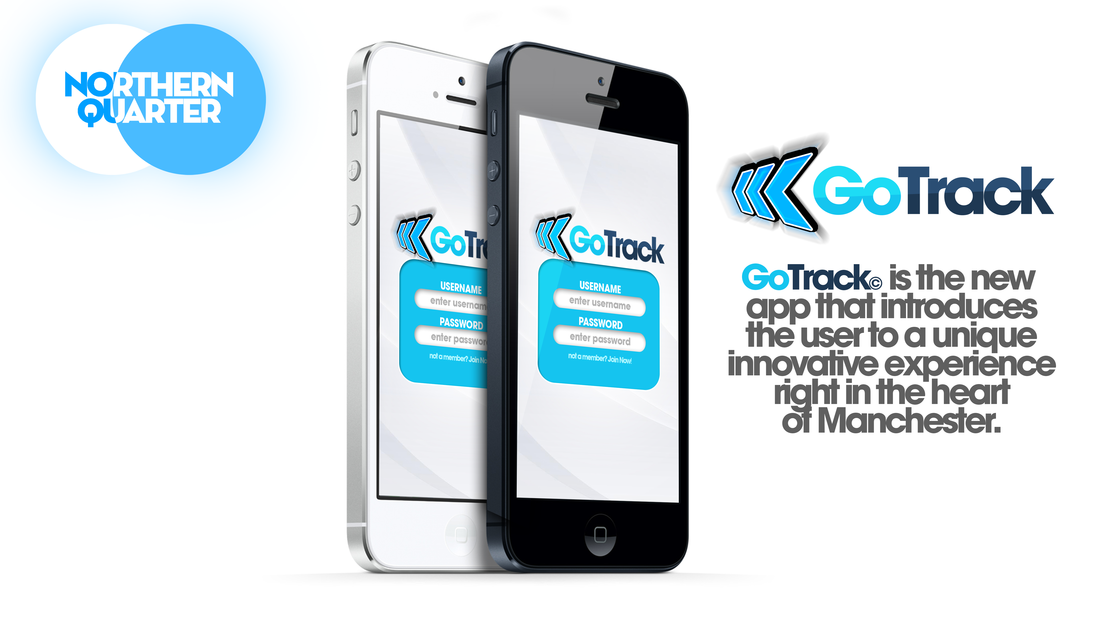
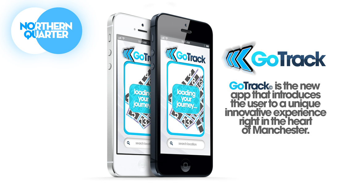
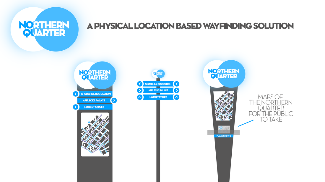
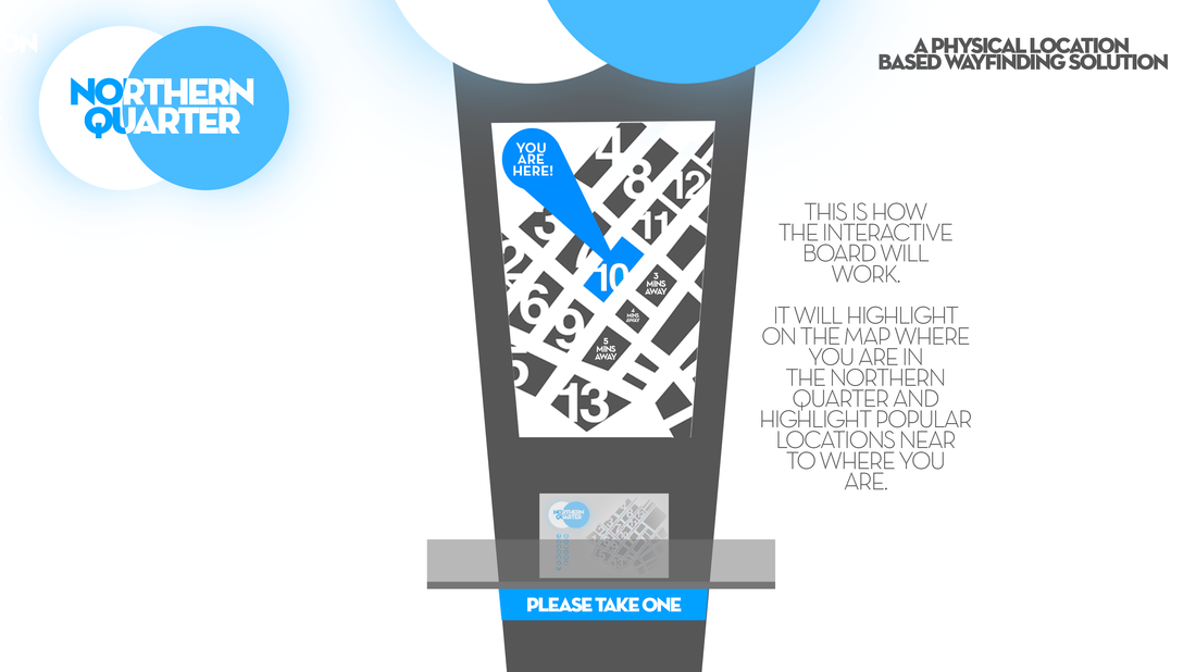
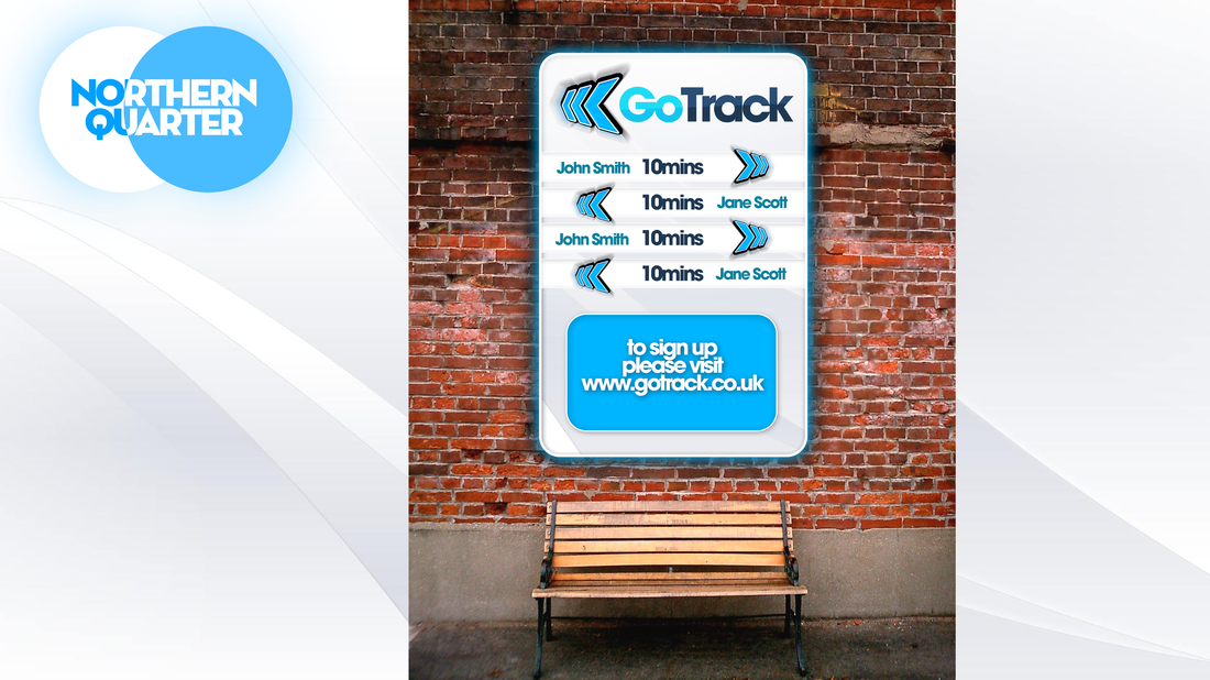
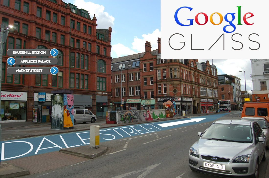
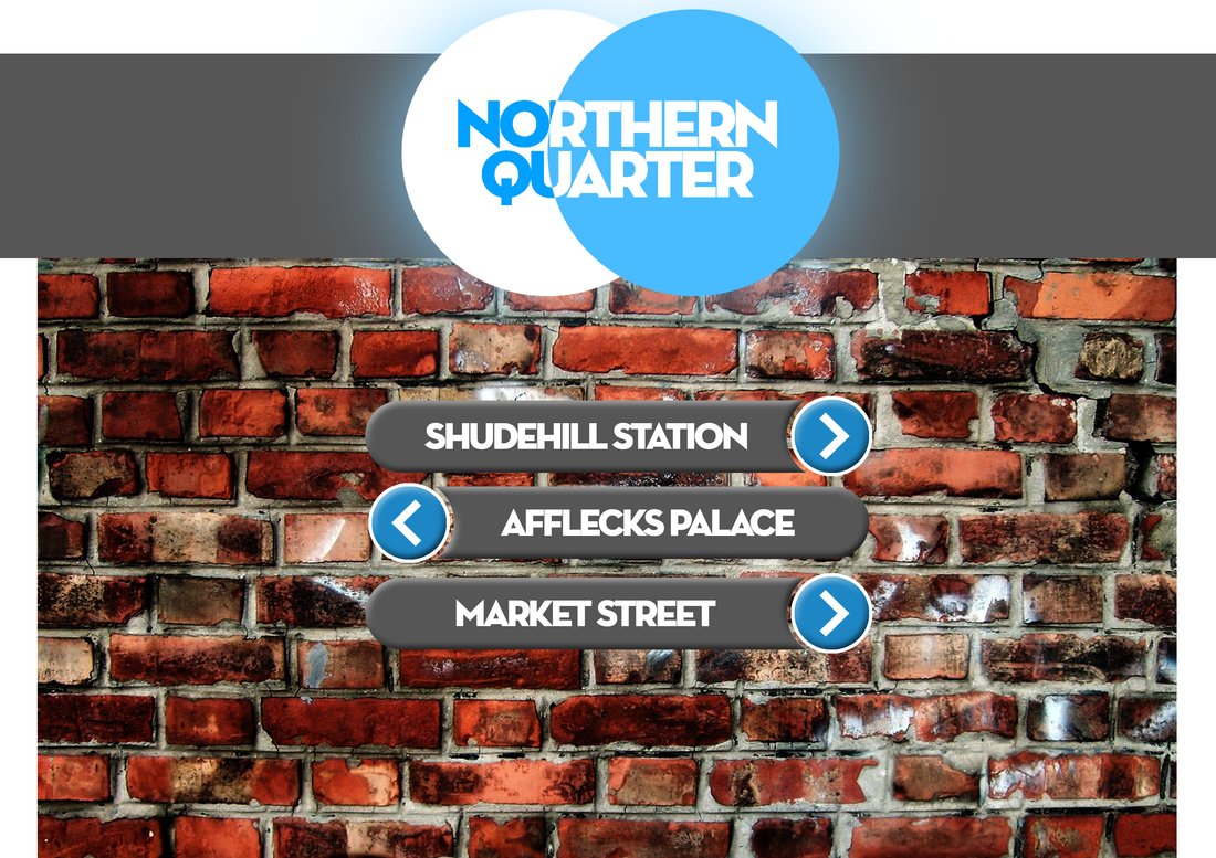
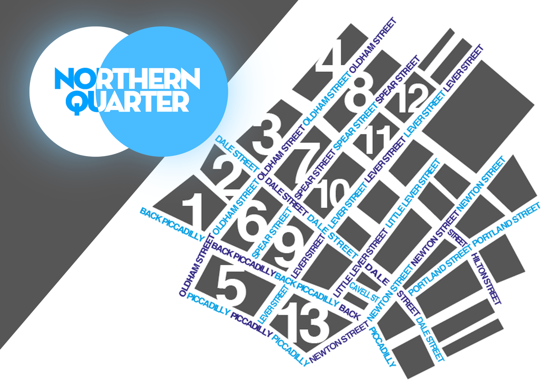
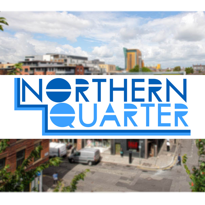
First I want to show you the first original copies of work that I showed at the last presentation so I can explain the changes that I've made and why I made them. Firstly I want to show you my first solution to the printed way-finding system. For the map I decided that I wouldn't go down the 'traditional' route of using colour to identify streets and just putting the name of the street at one place on the street. For me, that has always been confusing as you have to keep constantly checking whether your on the same street and then you can't find the name of the street because it's either too small or doesn't stand out enough. Because of this, I decided that my streets were going to filled with type. The street would be filled with the name of the street preferably large enough to fill the entire street and leave limited gaps. I think personally this really worked for this design as I felt it was original and stood out as I'd seen nobody doing this before. After the presentation, I was told that it look a bit flat and 2D which I fully agreed with. I was always told that it was a big hard to understand as within the building there are a number of establishments so how would I define them by using the single numbers. As you can see by this (Slide 3), I have give the map a little depth by adding a little inner shadow which made it stand out a lot more. It also makes the number clearer to read. I have also found a way to get around the building number problem. I have now divided the building into sections. For each building number I will use the most popular/successful establishment at the top of the list with the other places in that building in a smaller typeface underneath. I have done this as some people say things like "Do you know where this is?, it's near *insert popular shop*". This way, the people viewing the map can look at it and go "Oh I remember, it's near *insert shop*" and head towards that building listed with that shop. Next it's onto my Digital Design (App). (Slide 5). This is my app design that I came up with for the first presentation. At the point of the presentation, I wasn't fully happy with the app as it seemed too simple and lacked depth and that professional look that app should have. As soon as I had finished that presentation, I scrapped the original ideas and starting again with a blank canvas. The important thing this time for me was to create a whole brand around the app. I was looking at a couple of existing names for GPS apps and came across something called 'Track & Go'. I really liked this name so I rejigged it and rename my app 'GoTrack'. (Slide 6) The main thing with my app is that I wanted to be fully integrable with the physical way-finding solutions. I didn't want people using the GoTrack or Street signs. I wanted to be using the GoTrack along side the street signs. (Slide7) Here is how the start screen/log in screen on my app could look like. I took it down the traditional log in page features so that people would be familar with how to access the app (put in username and passwork and click go). (Slide8) How this works is that you enter a location or use GPS to a place that you want to visit on the map and then click 'Take me There'. Using the name you provided and while tracking your GPS, it will give you a real time estimate of how long and which direction to your chosen location. This is not just any simple app. It supports several other features which I will discuss a little later on. Next I'm going to talk about the physical way-finding solutions from the last presentation. Out of everything that I had originally did for the last presentation, this is the one thing that I was totally happy with. I felt that it brought the technology side and the physical side together in an effective way and it was executed to a good enough standard. The only thing that was missing for me was something that made it all more personal to the people use the app/interacting board on the signs. So I decided to fully integrate the GoTrack with the boards. How this will work is that when you register for the GoTrack, you will leave your name (full name optional) and active GPS. Therefore the GoTrack can become more useful for you. When you put a location to where you want to go in the app and press confirm. Your name, distance and directions will be send to one of our GoTrackStations where it will be displayed. (Slide 11). To prevent this from being irrelevant and to make it more viable, we will only send this information to the boards that will be along your route given to you via the GoTrack app. It also gives it a very personal touch and makes it more user friendly.
Thank you for listening. Any Questions?
Welcome to my presentation on my outcomes from this module. The first thing that I want to talk about is what I gained from the last presentation (Slide 2). Personally, the last presentation help a lot with my development with this module. It gave me and insight into what other people thought of my work and what they would improve. Some things that I wouldn't have gained without doing it.
First I want to show you the first original copies of work that I showed at the last presentation so I can explain the changes that I've made and why I made them. Firstly I want to show you my first solution to the printed way-finding system. For the map I decided that I wouldn't go down the 'traditional' route of using colour to identify streets and just putting the name of the street at one place on the street. For me, that has always been confusing as you have to keep constantly checking whether your on the same street and then you can't find the name of the street because it's either too small or doesn't stand out enough. Because of this, I decided that my streets were going to filled with type. The street would be filled with the name of the street preferably large enough to fill the entire street and leave limited gaps. I think personally this really worked for this design as I felt it was original and stood out as I'd seen nobody doing this before. After the presentation, I was told that it look a bit flat and 2D which I fully agreed with. I was always told that it was a big hard to understand as within the building there are a number of establishments so how would I define them by using the single numbers. As you can see by this (Slide 3), I have give the map a little depth by adding a little inner shadow which made it stand out a lot more. It also makes the number clearer to read. I have also found a way to get around the building number problem. I have now divided the building into sections. For each building number I will use the most popular/successful establishment at the top of the list with the other places in that building in a smaller typeface underneath. I have done this as some people say things like "Do you know where this is?, it's near *insert popular shop*". This way, the people viewing the map can look at it and go "Oh I remember, it's near *insert shop*" and head towards that building listed with that shop. Next it's onto my Digital Design (App). (Slide 5). This is my app design that I came up with for the first presentation. At the point of the presentation, I wasn't fully happy with the app as it seemed too simple and lacked depth and that professional look that app should have. As soon as I had finished that presentation, I scrapped the original ideas and starting again with a blank canvas. The important thing this time for me was to create a whole brand around the app. I was looking at a couple of existing names for GPS apps and came across something called 'Track & Go'. I really liked this name so I rejigged it and rename my app 'GoTrack'. (Slide 6) The main thing with my app is that I wanted to be fully integrable with the physical way-finding solutions. I didn't want people using the GoTrack or Street signs. I wanted to be using the GoTrack along side the street signs. (Slide7) Here is how the start screen/log in screen on my app could look like. I took it down the traditional log in page features so that people would be familar with how to access the app (put in username and passwork and click go). (Slide8) How this works is that you enter a location or use GPS to a place that you want to visit on the map and then click 'Take me There'. Using the name you provided and while tracking your GPS, it will give you a real time estimate of how long and which direction to your chosen location. This is not just any simple app. It supports several other features which I will discuss a little later on. Next I'm going to talk about the physical way-finding solutions from the last presentation. Out of everything that I had originally did for the last presentation, this is the one thing that I was totally happy with. I felt that it brought the technology side and the physical side together in an effective way and it was executed to a good enough standard. The only thing that was missing for me was something that made it all more personal to the people use the app/interacting board on the signs. So I decided to fully integrate the GoTrack with the boards. How this will work is that when you register for the GoTrack, you will leave your name (full name optional) and active GPS. Therefore the GoTrack can become more useful for you. When you put a location to where you want to go in the app and press confirm. Your name, distance and directions will be send to one of our GoTrackStations where it will be displayed. (Slide 11). To prevent this from being irrelevant and to make it more viable, we will only send this information to the boards that will be along your route given to you via the GoTrack app. It also gives it a very personal touch and makes it more user friendly.
Thank you for listening. Any Questions?
 RSS Feed